Research at GeoD Lab
Advancing Knowledge Through Innovative Research
Research Areas
Where ideas evolve into impactful discoveries.
Geodynamic Modelling
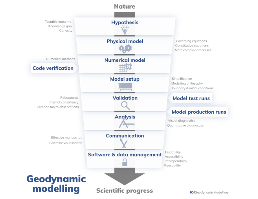

Our research in geodynamic modelling focuses on simulating the physical processes that shape the Earth's lithosphere and mantle over various spatial and temporal scales. We use advanced numerical methods to understand deformation, flow, and failure within Earth's interior, aiming to link subsurface processes with observable surface features.
Key Research Areas:
- Fracture Modelling & Earthquake Simulation: Studying rupture dynamics and fault evolution under varying rheological and thermal conditions
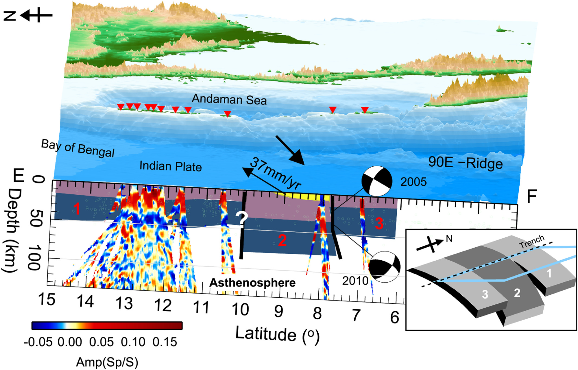
- Subduction Zone Dynamics: Investigating slab tearing, phase transitions, and accretionary wedge development
- Surface Process Integration: Coupling tectonics with landscape evolution and uplift history
- Continental Rifting: Modelling the link between lithospheric stretching and topographic changes
Applications:
- Physics-based earthquake hazard prediction
- Tectonic plate interaction analysis
- Understanding mountain building and rift formation
- Linking geophysical data with geodynamic theory
Statistical Seismology
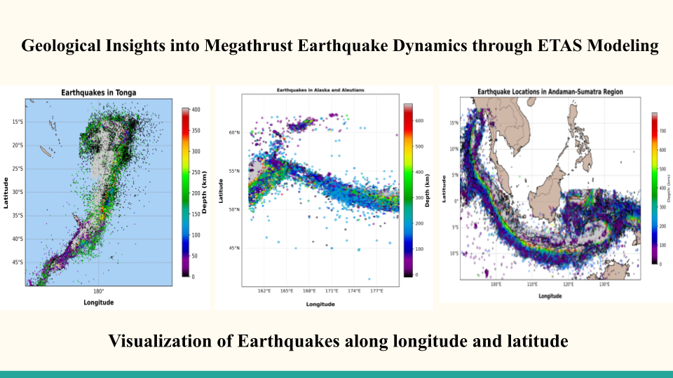
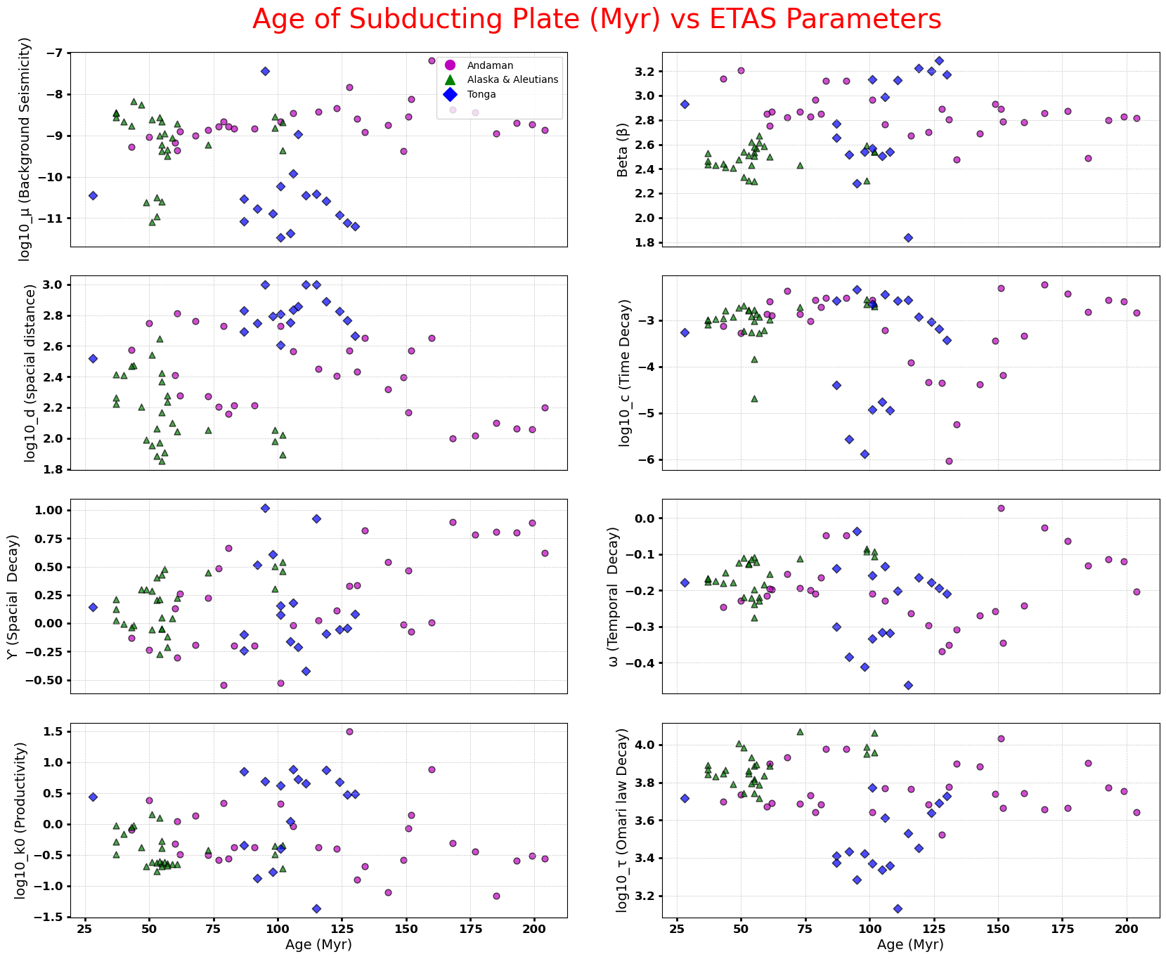
Our work in statistical seismology is centered on understanding the patterns, probabilities, and physical drivers of earthquake occurrence across spatial and temporal scales. By analyzing empirical regularities and developing stochastic models, we gain critical insight into fault system dynamics and seismic hazard.
Core Research Areas:
- Earthquake Clustering & Forecasting: Using ETAS and other models to study aftershock cascades and temporal patterns
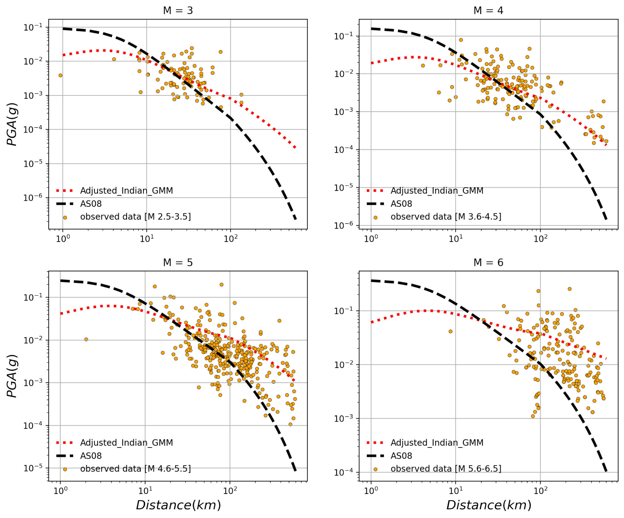
- Ground Motion Prediction Equations (GMPEs): Estimating site-specific shaking based on seismic source and path parameters
- Seismicity Pattern Analysis: Including b-value mapping, moment release trends, and foreshock-mainshock-aftershock sequences
- Probabilistic Seismic Hazard Assessment (PSHA): Quantifying long-term seismic risk under uncertainty
Applications:
- Improving regional earthquake forecasting
- Seismic risk modeling in complex tectonic settings
- Refining hazard maps in data-sparse regions
- Informing infrastructure design and mitigation strategies
Seismic Interpretation
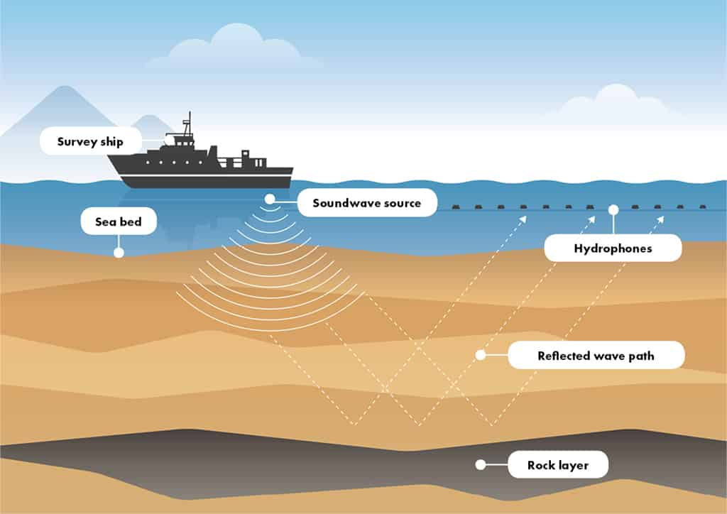
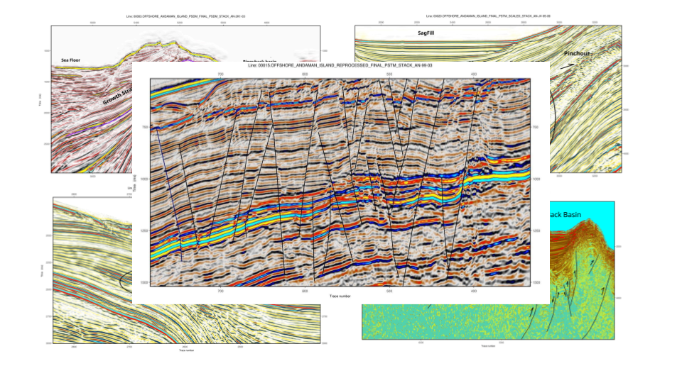
Seismic interpretation is a key pillar of our research, enabling us to visualize and decode the subsurface architecture of the Earth using 2D and 3D seismic reflection data. We focus on extracting geological insights from complex waveforms and reconstructing tectono-sedimentary histories.
Research Highlights:
- Stratigraphic Interpretation: Identifying sequences, unconformities, and depositional environments
- Fault and Structure Analysis: Mapping faults, folds, and interpreting tectonic regimes
- Hydrocarbon Prospecting: Locating reservoirs, traps, and seal configurations using seismic attributes
- Attribute & Amplitude Analysis: Using AVO and coherence for lithology and fluid prediction
Integrated Modelling:
- Coupling seismic interpretation with geodynamic simulations of rifting, subsidence, and magmatism
- Modeling tectonic events to explain basin evolution and structural inheritance
- Linking deep Earth processes to sedimentary basin development and resource distribution
Current Research Projects
Ongoing research initiatives addressing contemporary challenges
heading
Ongoingsummary
project-2
Ongoingsummary
project-3
Ongoingsummary
Recent Publications
Explore our latest research contributions
title
venue
titlt
venue
title
venue
Research Collaborations
Building partnerships to amplify research impact